From: Brighton, Sussex UK
Started: 20240829
Finished: 20240901
Cotswold Way 29th August – 1st September 2024
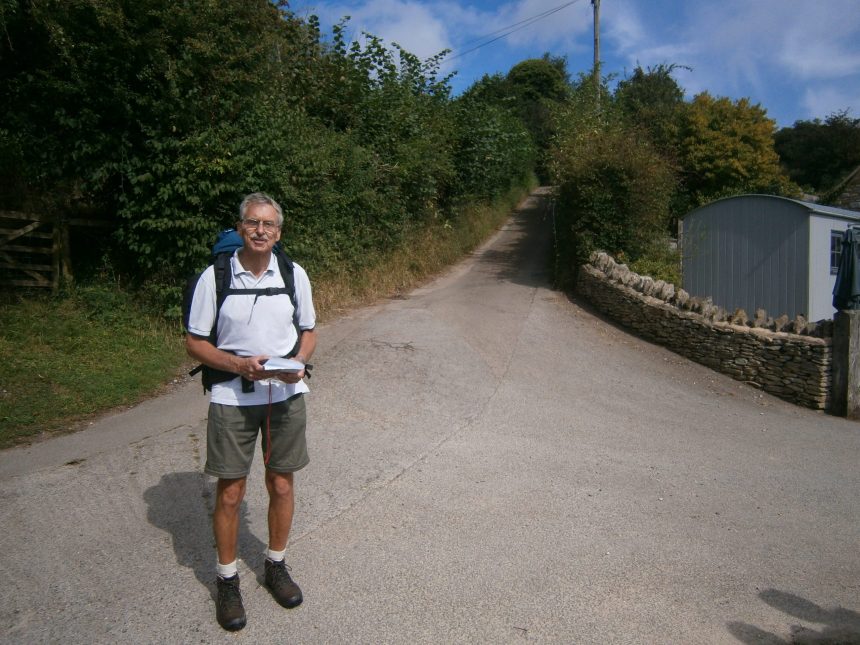
I was very kindly assisted by a friend in Cricklade who I stayed with overnight before starting the walk. I was going from south to north, so starting in Bath and walking to Chipping Campden. The transport to the start of the walk worked perfectly, a bus to Swindon and train to Bath, so I started the walk at 7:55am on Thursday 29th of August. The weather was perfect, bright and a bit sunny without being too hot. I had food for four days and all the usual camping equipment.
I had prepared detailed maps to navigate my way out of Bath and was soon in open country on the Cotswold Way itself. I made good progress and was enjoying the beautiful countryside when I met three Americans from Idaho near the monument to a civil war battle in 1643 and I was able to fill them in on bits of British history from around that time. It transpired that they were Mormons and they were able to enlightened me on various aspects of their church, strange as they may be.
I stopped for a very welcome lime and soda at the Dog Inn in Old Sodbury, before continuing on to Hawksbury Upton. I had covered around 25 miles and rapidly went to sleep, only to be woken up later by a fox that insisted on barking about every twenty seconds for several minutes. Having drifted back to sleep I was awoken by an extraordinary owl, not the usual noises but clearly very close to me, and another owl echoing the calls about a hundred metres away. The sound was so enchanting that I didn’t mind the disturbance to my sleep at all.
Next morning, after breakfasting, I set off and managed to go wrong immediately, somehow missing a turn and at this moment I used some electronic assistance. I had my phone with me but obviously charging it was a problem, so I kept it turned off unless I needed some help with navigation.
Having recovered the route, I carried on walking through beautiful countryside to Wootten Under Edge where I stopped for tea and cake before climbing to the splendidly named village of North Nibley. Just before the village is a monument to William Tyndale, the views from which were marvellous. However, just past the monument there appeared to be sign indicating that the route descended steeply through some bushes down to the road. I set off down the track only to find that the bushes became very thick to the point of being almost impenetrable. As I attempted to find where it went I somehow lost my footing and, as the slope was extremely steep at this point, went hurtling down the hill, rolling over a couple of times on the way. I tried digging my heels into the top surface to arrest my fall but it was far too loose and I ended up sliding the last few metres to the path below on my rear end. My unorthodox arrival back on the track startled an approaching couple and their dog but they kindly pointed out the short loop to the north which I should have taken. Amazingly, I had escaped any serious injury but was covered in dents and scratches which fortunately soon stopped bleeding. Having dusted myself off I carried on to Dursley and the rather stiff climb onto Cam Long Down where I had lunch while taking in the fantastic views from the top.
The afternoon saw me skirting Stroud and climbing to Standish Wood. The path was perfect for making fast progress, even and fairly flat. I headed on until I reached the car park near a great viewpoint just as the light was fading. The light was fading, giving way to a beautiful sunset but it was soon fully dark and there were still about ten cars in the car park. I started talking to a lady with a dog and it transpired she owned a small stretch of adjacent land and offered to let me camp there. I gratefully accepted and her kind hospitality extended to making me tea in the morning and allowing me to charge my phone. Bidding her goodbye the next morning I set off on day three of my walk. The beautiful weather was still holding and I just enjoyed the views as I passed through Painswick Beacon and Cooper’s Hill, scene of the famous cheese rolling on Spring Bank holiday, in which participants race down the 200 yard long hill chasing a wheel of Double Gloucester cheese.
Hartley Hill provided more magnificent views as I walked around the top before dropping down to the major roadworks at the junction of the A435 and A436. A further descent brought me to an Indian restaurant in the late afternoon and I went in and had a coke and a pot of tea. By this time I looked a right mess and my somewhat manky state meant that I had my refreshments in the area reserved for people collecting takeaways. A fairly gentle climb brought me to the hills east of Cheltenham on the approach to Cleeve Common. At some point I heard music and, this being Saturday night, I did wonder if a group of people had come to the disused quarry for some sort of gathering. Fortunately, the music never got near and I soon drifted off to sleep.
Next morning I set off towards Cleeve Commons which promised spectacular views over Cheltenham and the racecourse but, unfortunately, it was rather misty so the views were somewhat obscured.
As I approached the village of Winchcombe I had the only rain of the entire trip when a heavy shower caused me to rapidly don my waterproofs but it didn’t last that long. Someone on the high street recommended that I stop for refreshment at Hailes and I duly took the opportunity for tea and crumble which was most welcome. The only downside being that all the outside tables were occupied and I ended up crouching at a small table inside the cafe itself on the downwind side so as not to put the other customers off.
After climbing through Hailes Wood I was then in open country, going past the impressive entrance to Stanway House and reaching the village of Stanton. This was Cotswold chocolate box country at its very best. Beautiful stone buildings and as I walked down the main street a couple of horse riders clip clopped slowly past. Immediately afterwards came one of the steepest climbs of the entire route to Shenborrow Hill, after which I stopped for a welcome lunch. A gentler section took me to Broadway which proved to be an extraordinary honeypot on a Sunday afternoon with crowds of people attending the numerous cafes and antique shops. Eventually, after squeezing through the crowds, I left the village for last climb on the route and made the steady ascent to Broadway Tower. The end was almost in sight and there just remained a stroll to the viewpoint at Dover’s Hill before dropping into Chipping Campden and the finish. I arrived at about 5:45pm and had arranged a lift for Monday so had to find somewhere to pitch my tent that night. I talked to a couple of Americans on the high street who suggested I go to tourist information. Thinking that that they would never be open at that time on a Sunday, but wishing to be polite, I thanked them and made my way to the office which to my amazement was still open. A dedicated member of staff listened to my tale, phoned a friend at a local farm and arranged for me to camp there. It turned out to be a lovely spot, about a kilometre east of Chipping Campden. I was also able to have a much needed shower and next morning walked back into the village for breakfast and my lift.
Overall, it was a lovely route, very well signposted and with spectacular views all along the way. I also found that most of the people I spoke to were American. Whilst I was waiting for my lift two separate groups of Americans appeared and were briefed by a guide before setting off on a walk. Presumably they are encouraged to visit what is quintessentially English countryside. Having completed the hundred miles in four days I was glad to take the weight off my feet but had greatly enjoyed what must be one of the loveliest trails in the UK.